➡️Product description
LMX200 GPR
Pushing the Boundaries of Underground Understanding with Advanced Technology: Explore the Depths with Our GPR Product
Underground Imaging - LMX200™ GPR Radar is used to detect underground materials that cannot be accurately located. It provides unparalleled accuracy.
GPR Radar Underground Imaging Features
◼️PVC ve asbestli çimento dahil metalik olmayan borular
◼️Yeraltı Elektrik Kablosu
◼️Beton yapılar ve kanalizasyon sistemleri
◼️Kurulu izleyici kablolamanın başarısız olduğu yardımcı tespit araçları
◼️Yeraltı depolama tankları ve drenaj karoları
◼️Septik sistem bileşenleri
◼️Tonozlar, temel duvarları ve beton pedler gibi hizmet dışı yapılar
Yer Altı Görüntüleme Radarı
Subsurface Imaging - Public utility systems and local governments require the location and marking of underground systems. This helps in project planning and avoiding risks and hazards. It features a powerful Grid Scan mode and the ability to utilize an external GPS for full advantage of SplitView and MapView
LMX200 GPR Radar Software
EKKO PROJECT
LMX200™ ayrıca EKKO_Project™’It allows data transfer for post-processing, archiving, referencing, and other mapping capabilities. video
◼️GPR verilerini, fotoğrafları ve diğer dosyaları tek bir proje (.GPZ dosyası) olarak düzenleyin
◼️Bulgularınızın PDF GPR özet raporlarını kolayca oluşturun.
◼️GPR hatlarına yorumlar, fotoğraflar, ses ve video ekleyin.
◼️Izgaralı veya ızgarasız derinlik dilimleri oluşturun.

#ekko Project – LMX200 Underground Imaging Radar: "Underground" "GPR"
System Upgrade Enhancement
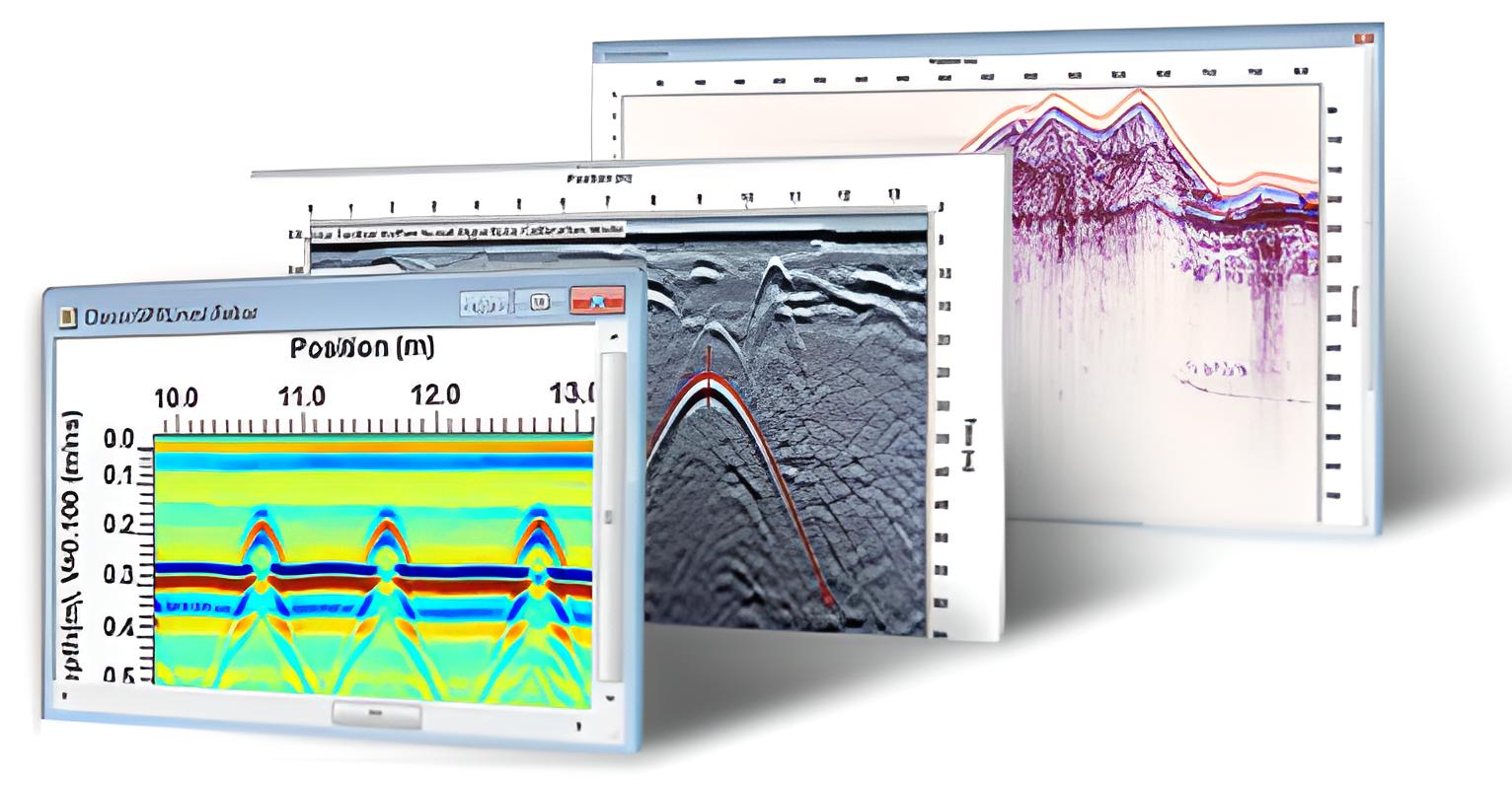
The enhancement system utilizes the EKKO Project software for data management, data integration, and GPR data visualization
MapView guide lines and GPR lines collected with GPS
View GPR lines and save them as graphic image files such as jpg, bmp, png - Slice up and down in the depth view to reveal targets
Create impactful reports, add photos, text, and print as PDF
Assistive Upgrade Applications
The EKKO Project software can be enhanced with the Utility Suite software for more advanced reporting
The LineView module for changing and viewing GPR lines.
SliceView Module for Modifying and Viewing Depth Slices from GPR Grid Data in Google Earth Files
The annotation module for adding post-processing GPR lines, multiple lines, boxes, and additional comments
Go to the presentation page about LMX 200


![22686[1] - Enermak Enerji Marker Mate EML100](https://enermak.com/wp-content/uploads/2022/04/226861.jpg)
![405w_biogas_bild_54x41_procal[1] - Enermak Enerji](https://enermak.com/wp-content/uploads/2022/04/405w_biogas_bild_54x41_procal1-1-320x308.jpg)


enermak –